Hydrogeology、 Engineering Geology and Environmental Geological Survey
Hydrogeology survey is a study of groundwater and its related geological processes in order to ascertain the hydrogeologic conditions of an area. It includes hydrogeological mapping, exploration, test, water quality analysis and long-term observation of groundwater dynamics. According to different purposes and requirements, it can be divided into comprehensive hydrogeology survey and special hydrogeology survey. Comprehensive hydrogeological survey is to grasp the regional or regional hydrogeological conditions and provide basic information for various types of construction of national economic and social development. Specialized hydrogeology survey is to solve a practical problem related to groundwater in production, such as water supply hydrogeology survey, deposit hydrogeology survey and soil improvement hydrogeology survey.
Engineering geological survey is an investigation and study on topography, geomorphology, stratigraphic lithology, geological structure, natural stress state of rock (soil), hydrogeological conditions, various natural geological phenomena, geophysical and mechanical characteristics of rock and soil, natural building materials and other related geological functions in order to ascertain the engineering geological conditions of an area. It includes engineering geological mapping, engineering geological exploration, field experiment, indoor analysis test and long-term observation. According to different purposes and requirements, it can be divided into comprehensive engineering geological survey and specialized engineering geological survey. Comprehensive engineering geological survey is to grasp the regional or regional engineering geological conditions and provide basic information for various types of construction of national economic and social development. Specialized engineering geology survey is to solve a practical problem related to engineering geological conditions in production, such as karst engineering geology survey, goaf engineering geology survey, reservoir engineering geology survey and roadbed engineering geology survey.
Environmental geological survey is to investigate and study the basic environmental geological conditions, environmental geological problems and geological hazards for the purpose of ascertaining the environmental geological conditions of an area, and to carry out corresponding analysis and evaluation, as well as various geological functions related to them. It includes environmental geological mapping, environmental geological exploration, field experiment, indoor analysis test and long-term observation. According to different purposes and requirements, it can be divided into comprehensive environmental geological survey and special environmental geological survey. Comprehensive environmental geological survey is to grasp the regional or regional environmental geological conditions and provide basic information for various types of construction of national economic and social development. Specialized environmental geological survey is an environmental geological survey and research work for a specific purpose or purpose, especially for a certain environmental geological problem or geological hazard. Such as urban environmental geology survey, mine environmental geology survey, agricultural environmental geology survey, reservoir environmental geology survey, ecological environment geology survey and so on.
Typical Projects:
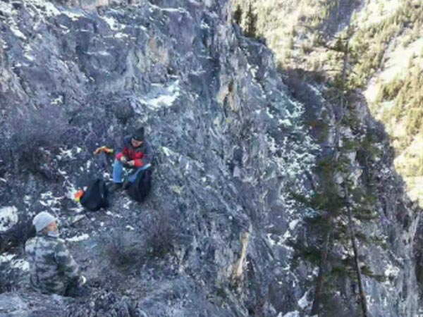
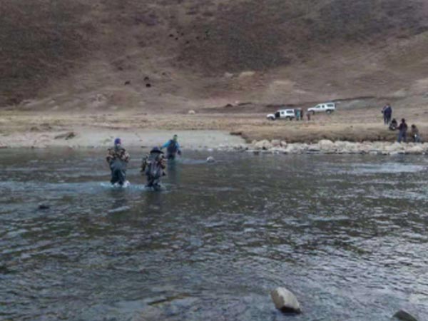
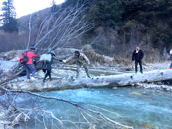
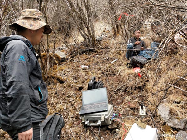
Geophysical Prospecting Tunnel Exploration Project in a Preliminary Survey Stage of theNewly Built Sichuan-Tibet Railway: The survey area is located in the high mountain area of the western Sichuan Plateau in the eastern edge of the Qinghai-Tibet Plateau. The valleys are deep, the terrain is steep, the mountains are undulating, the valleys are vertical and horizontal. The natural field audio-frequency magnetotelluric method is used to survey the occurrence of faults (apparent dip angle), the width of fragmentation and the fragmentation, weakness, karst development or water-rich The depth and scale of rock mass provide basic information for tunnel design.
Transient Electromagnetic Exploration Project of Mine Funing: The geological condition, goaf and influence area of the lower part of the water-resisting curtain are detected and identified by using the transient electromagnetic geophysical method, which provides a basis for the construction of grouting engineering.