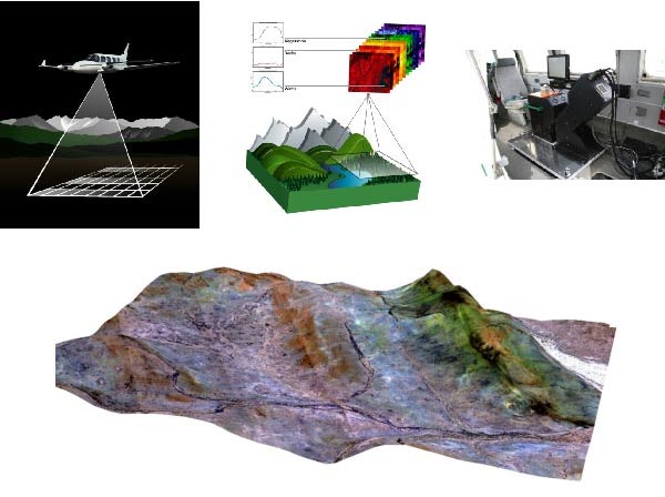
The CASI1500h and SASI600 introduced by GEA are the advanced airborne wide array hyperspectral imaging systems in the world. Through remote sensing flight, the fine spectral curves of vegetation, rock mass, soil, water, road and building on the ground can be obtained quickly, and the fine recognition of ground objects can be realized. Widely used in geological and mineral exploration and development, ecological environment monitoring and protection, agricultural, forestry, animal husbandry and fishery production and income increase, urban development monitoring, land development and utilization. Under the requirement of the same spectral resolution, it has higher spatial resolution and coverage, and is equipped with high-quality attitude system and stable platform. It has higher working accuracy and efficiency than other sensors.
GEA is equipped with core scanning and tripod scanning accessories at the same time, which can measure the fine spectrum of samples in the laboratory and meet the requirements of precision measurement.
Hyperspectral remote sensing technology is mainly used for ecological and environmental survey and resource exploration.
◆ 大气:涉及大气质量评价,空气污染物识别评价,如PM2.5、PM10,氮氧化物、二氧化碳等含量反演;
◆ 水体:包括海洋调查、内陆水体调查(湖泊、河流);可实现水质分级,藻类识别,矿物质含量反演,水体污染探测、海岸带调查;
◆ 植被:包括农业、林业、牧业调查;生物量反演,植被精细分类(农作物精细分类、林木精细分类、牧草分类)、生物蓄积量估算(林木蓄积量、农作物产量、牧草产量);植被品质评价(牧草品质、农作物品质、肉类品质);植被病虫害监测;
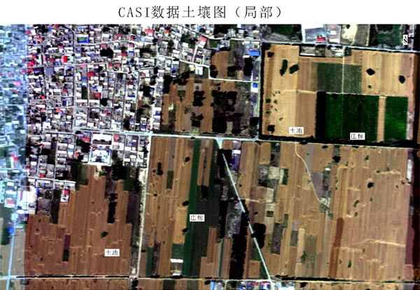
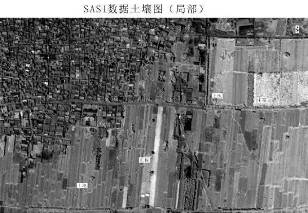
◆ 土地土壤:涉及农业林业牧业,土地分类、土地利用现状精细调查;土壤分类、土壤养分评价、土壤墒情评价、含水量评价,土壤污染探测;
◆ 岩矿:涉及地质调查和矿产勘查:可以实现地质填图、矿物识别、蚀变矿物填图、冶选环境污染和影响评价
◆ 城市:涉及城市环境调查评价:城市道路材质识别与分类,屋顶材料识别与分类,热岛效应、城市生态调查,城市水体固体污染识别,生活及工业污染监测,海绵城市基地调查。
Project Examples
I.Classification of Black and Odorous Water by Hyperspectral Remote Sensing in a certain Area
From March to August 2018, an aerial hyperspectral flight operation was carried out in a certain area. High quality data of about 3,000 km2 in the new area were obtained. At the same time, corresponding geochemical analysis and water quality measurement were carried out, and a classification model of hyperspectral black and odorous water body was established. The grade of black odor can be divided into three grades. The grade of black odor can be divided into three grades. The grade of black odor can be classified as severe black odor. The grade of black odor can be classified as mild black odor. The extraction results show that the water quality near the shore is higher, far from the shore and near the center of the water area is better.


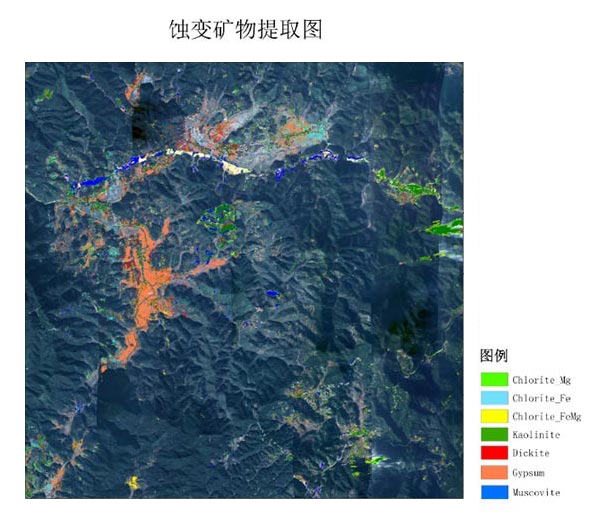
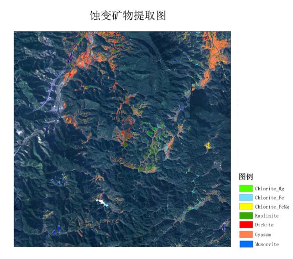
II.Alteration Mineral Extraction in a Certain Area
In November 2017, Airborne Hyperspectral Remote Sensing flight was carried out in a certain area. At the same time, corresponding geochemical exploration and ground spectral survey were carried out. Alterated minerals were extracted from the survey area, and good results were obtained through ground verification.